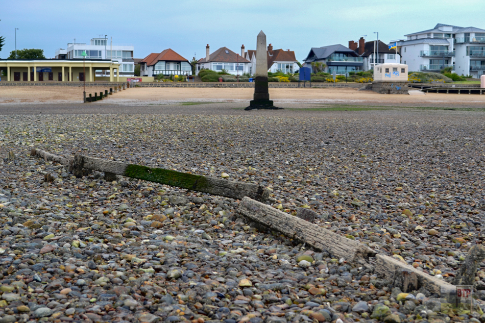
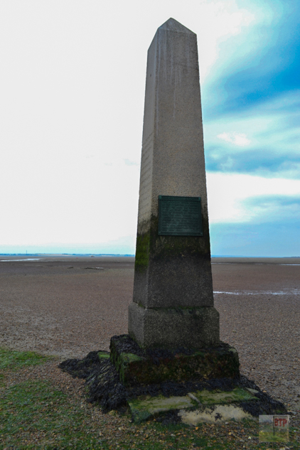
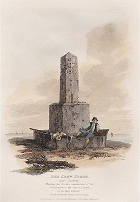
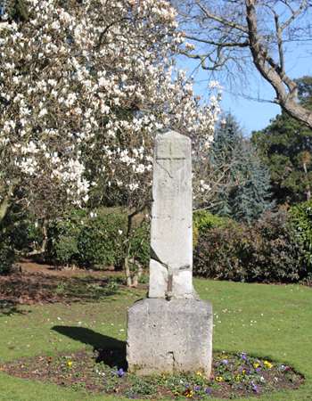
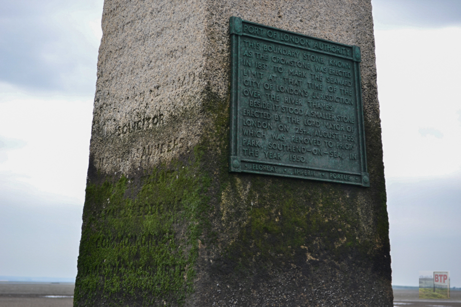
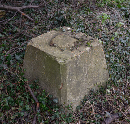
A few metres out into the river at Chalkwell Beach lies a peculiar obelisk stranded in the water. From the shore, it looks like a mysterious ruin of an ancient civilisation, although it is in fact the ‘Crowstone’ installed in 1836/7. It replaced a smaller stone post that was set in place in 1755. The Crow Stone is a London stone which at the time marked the seaward limit of the River Thames under the City of London’s jurisdiction. The old and new stones did infact stand together side-by-side until the Port of London Authority presented the old stone to Priory Park in 1950 where it still stands today (pictured).
The 1755 stone is now known to have replaced a missing stone which stood there prior. This is described in an essay of water bailiff Roger Griffiths in 1746:
…about two miles below this town [of Leigh] the jurisdiction of London on the Essex side of the river terminates at a place called Crow Stone, where there was a mark stone, but by some accident it has now been lost for these several years.”
There could have been numerous different posts and markers on this site as far back as seven-hundred years. The current Crow Stone features a plaque on either side describing those involved, and the stone’s purpose and origins.
Abandoned Causeways
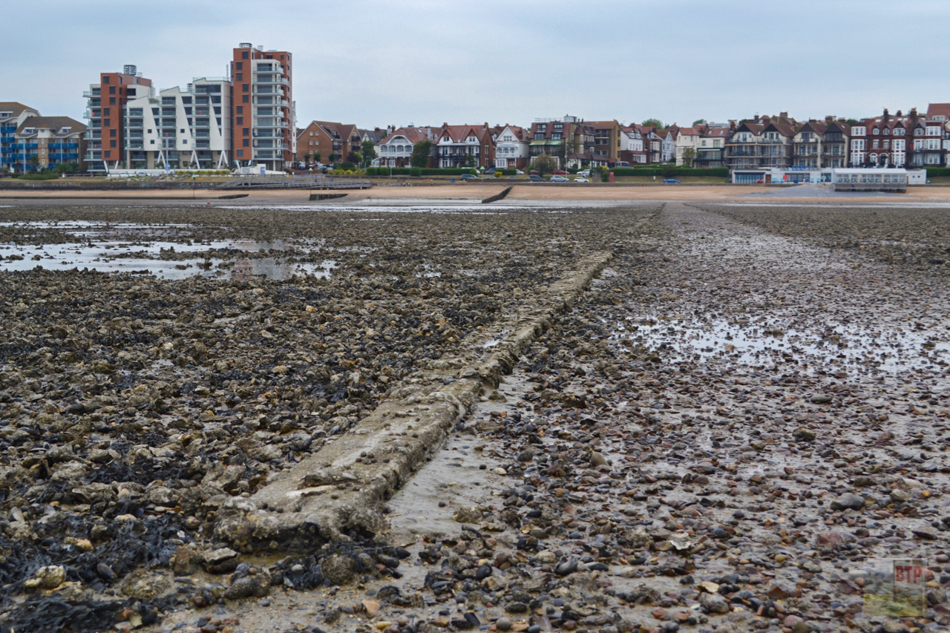
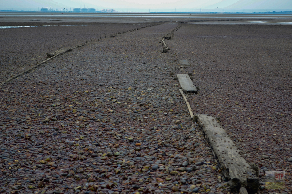
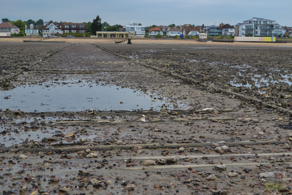
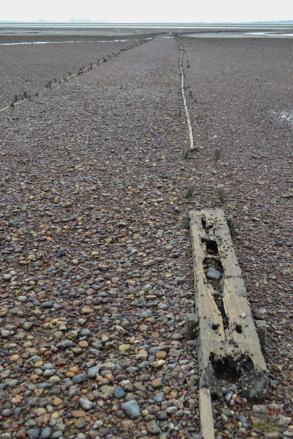
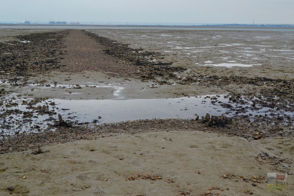
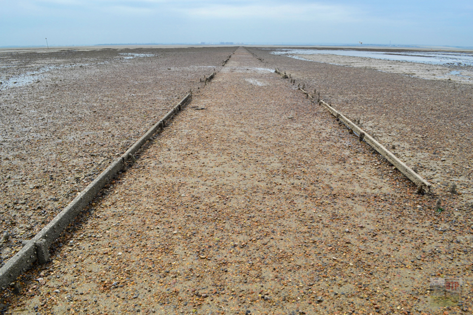
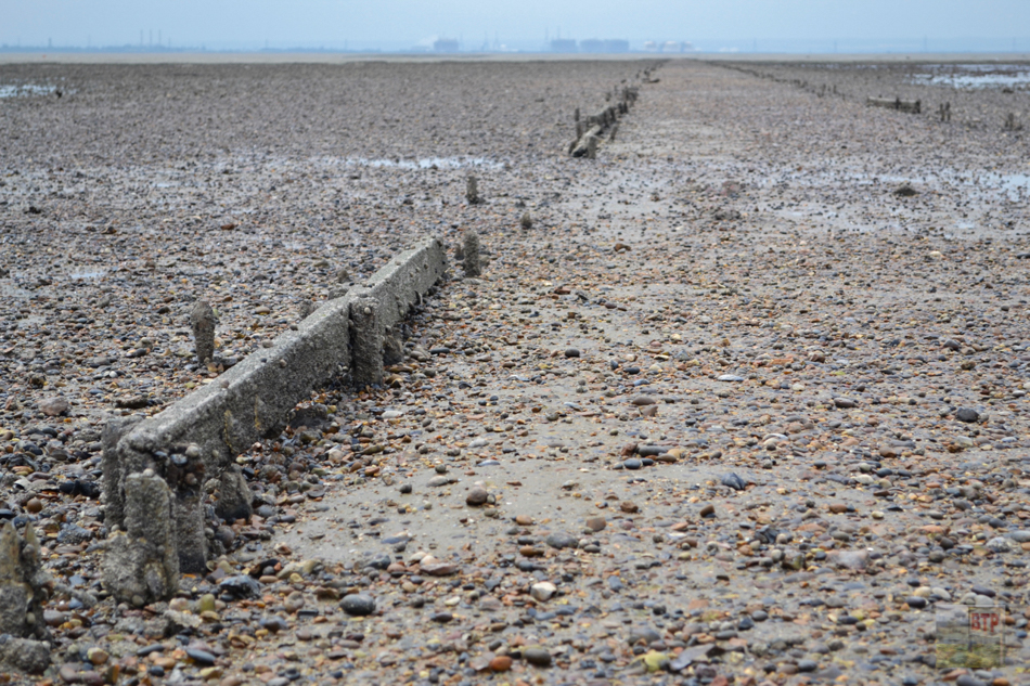
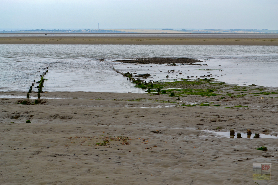
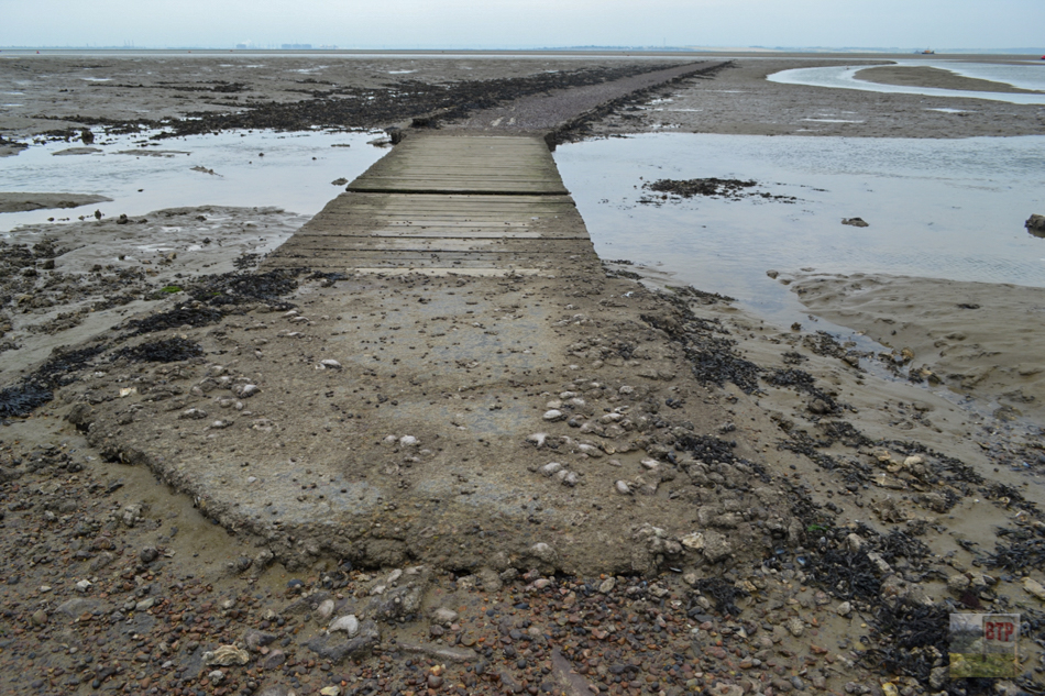
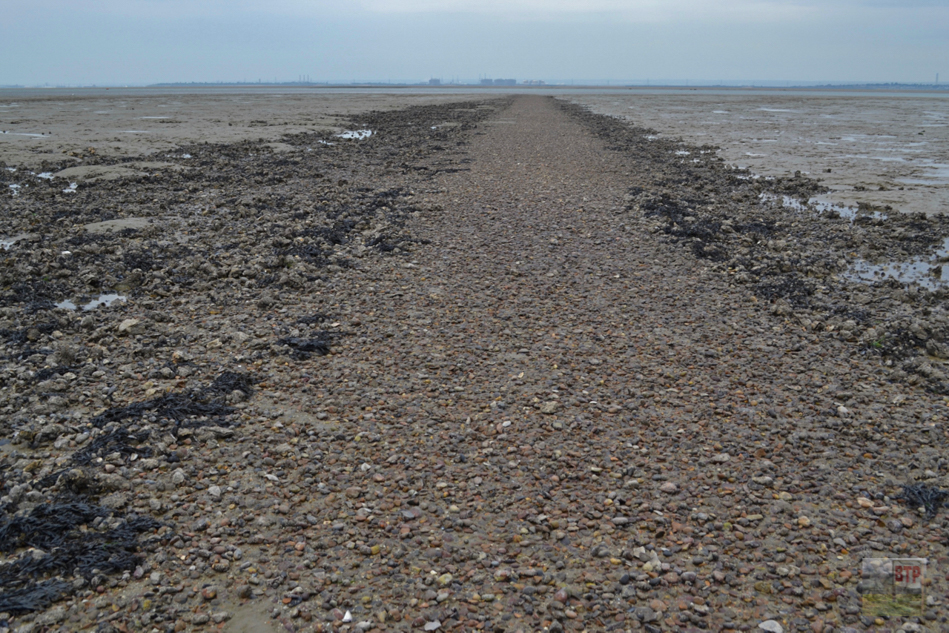
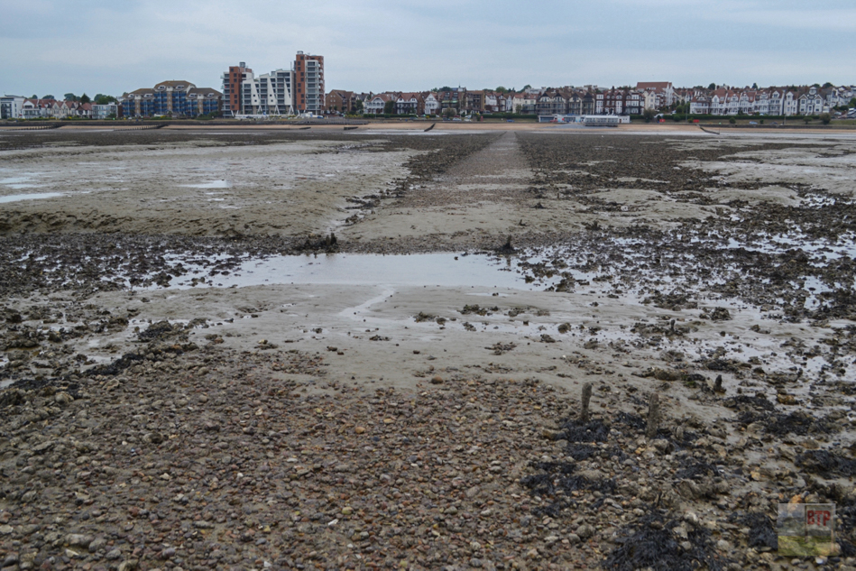
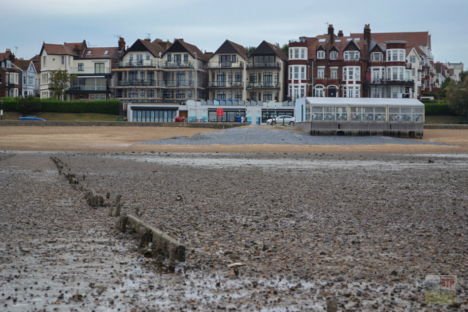
Directly adjacent to the Crow Stone and further east along the shore lie two abandoned pathways going out into the deeper water which becomes the Ray tributary of the Thames going between Hadleigh and Benfleet where it narrows. This suggests these pathways were causeways/slipways for fishing boats to reach deeper water – potentially to serve the traditional Leigh oyster industry. We actually found numerous oyster shells littered along the sides of one of the paths which could’ve been discarded long ago or simply show that oysters were common in this area of water. The paths are mostly made of raised areas of pebbles in the mud with very low rotten wooden fences or sleepers marking the sides. Metal chains and pipes can be found buried into the pathway today, and a concrete-set wooden bridge over a channel can be found at the end of the western path. Wooden stakes continue into the deep water at the end of this causeway – would it have continued further or even had a jetty at the end?
A discussion on the great Facebook group Ros’ Southend Past & Present reveals numerous opinions over the story behind these mysterious rotten pathways. It seems most likely they were built to allow vessels out into the Ray and deeper water of the Thames. Their age is unclear – considering the traditional lifespan of the Leigh fishing industry they could be as recent as the mid 20th Century or as old as the 15th Century. However, it seems most likely they are Victorian. A poster Alan Robbo on Ros’ forum shared a photograph of one of the pathways stating how during WW2 they were built to run out anti-aircraft guns during low tide to get closer to German bombers running down the Thames. His source was an ex-Home Guard member. No other mention of this or alternative uses for the pathways can be found. Many people challenged Alan’s claim, arguing that they had heard the paths were sewage outfalls (which may correspond with the pipe) or cockle fishing/barge slipways. Other locals rumour the pathways were used for tourists to take in the allegedly healthy sea air. A nickname for the pathways emerged – the ‘Hard Path’. The best conclusion to make is that their proximity to deep water suggests these were almost definitely for use by boats, although temporary adaption for use by the Home Guard during the Second World War could have occurred too. Some responders were cynical of Alan’s claim, arguing that wheeling guns out into the River for only a few hours each day simply to get a few hundred feet closer to enemy aircraft in the sky seems unnecessary. Another responder claims his grandfather believes the cinder pathways were installed for wartime use, but instead to allow troops to embark on troop-carrying ships headed for the D-Day landings to ease the heavy road congestion. A local fisherman then stepped in to say with conviction that the pathways were used to bring oysters and cargo ashore from Thames Barges, and were made with elm decking wide enough to allow horse and carts to travel down. He suggests these were built around 1700 when the Southend foreshore oyster fishery was of national heights. Another local explains how he was told without provenance that the paths were built by Milton brick company to fill wagons with water as the tide came in as the company did not have access to a stable water supply. Maybe evidence will emerge to convince us of the true story behind the ‘Hard Path’, but for now, we may never know…
After posting the above article in Ros’ group, some discussion with locals transpired that reveals more about the age of the paths – although their use is still a mystery. The conversation follows:
Warwick Conway: There were at least 6 of these Hard Paths. They first appear on the OS map for 1939. The shortest path began at the east end of Leigh High Street and extended only as far as Leigh Creek. Others were located (from west to east) by the Crowstone and putting green on Chalkwell Esplanade; by Westcliff Jetty and the Leas; below the Cliffs Pavilion; opposite the Esplanade Restaurant; between the Ship Hotel and Kursaal entrance (where I believe there is a car park today). In 1939, all but the ones at the Crowstone and Westcliff Jetty began on the shoreline and coincided with steps in the sea wall. By 1950, the beach end of these paths had also disappeared and they began further out, where the groynes ended. The Crowstone path curves and ends near a small creek (beyond the footbridge over a very narrow offshoot of the creek). The paths east of the Crowstone were all perfectly straight and ended somewhere in the sand and mud flats. Some paths are very close to ward boundaries that were formerly used to determine fishing rights. It may be that the paths had various uses over time and were a standard method of providing access to areas beyond the shoreline.
BTP Liam: Hi Warwick that’s great info I shall investigate! Any ideas on the paths’ uses? I guess 1939 could suggest wartime use but they seem clearly to be there to get vessels out into the water rather than for guns as was suggested
Warwick: Their non-appearance on earlier maps does not necessarily mean they did not exist in some form but I should say this is unlikely because the offshore sections of those maps were very detailed in other respects. Nor does their appearance on the 1939 map necessarily mean they were constructed at that time. The map survey prior to 1938/1939 was in 1922/23 and so all that I can say for certain is that they are not marked on the 1922 map but are marked on the 1939 map. It is possible the paths appeared at any time in the 1922-1938 period.
I do not know what they were used for but in my opinion, the Leigh path was there to provided access to Leigh Creek. I cannot think of any advantage in taking an AA gun that short distance along the path. Having seen photographs (here) of people carrying baskets of cockles from the boats, I wonder if the Leigh path may have been used for carrying the catch from a boat in the creek. The other paths may have simply provided firmer footing and therefore a quicker route for those going out on the mud flats (to collect cockles or dig for bait). But they could just as well provided a means of carrying a gun offshore although I am not sure what advantage there may have been in doing this. I know from previous posts that some members here have connections with shellfishing families and some have knowledge of wartime defences. Perhaps someone else can help with this.
This link will take you to the site I used and will hopefully put you in Southend in 1939. You can move about and zoom (although only certain maginfications are available for free) and choose maps from the list at the left –
https://www.old-maps.co.uk/#/Map/587500/186500/12/101204
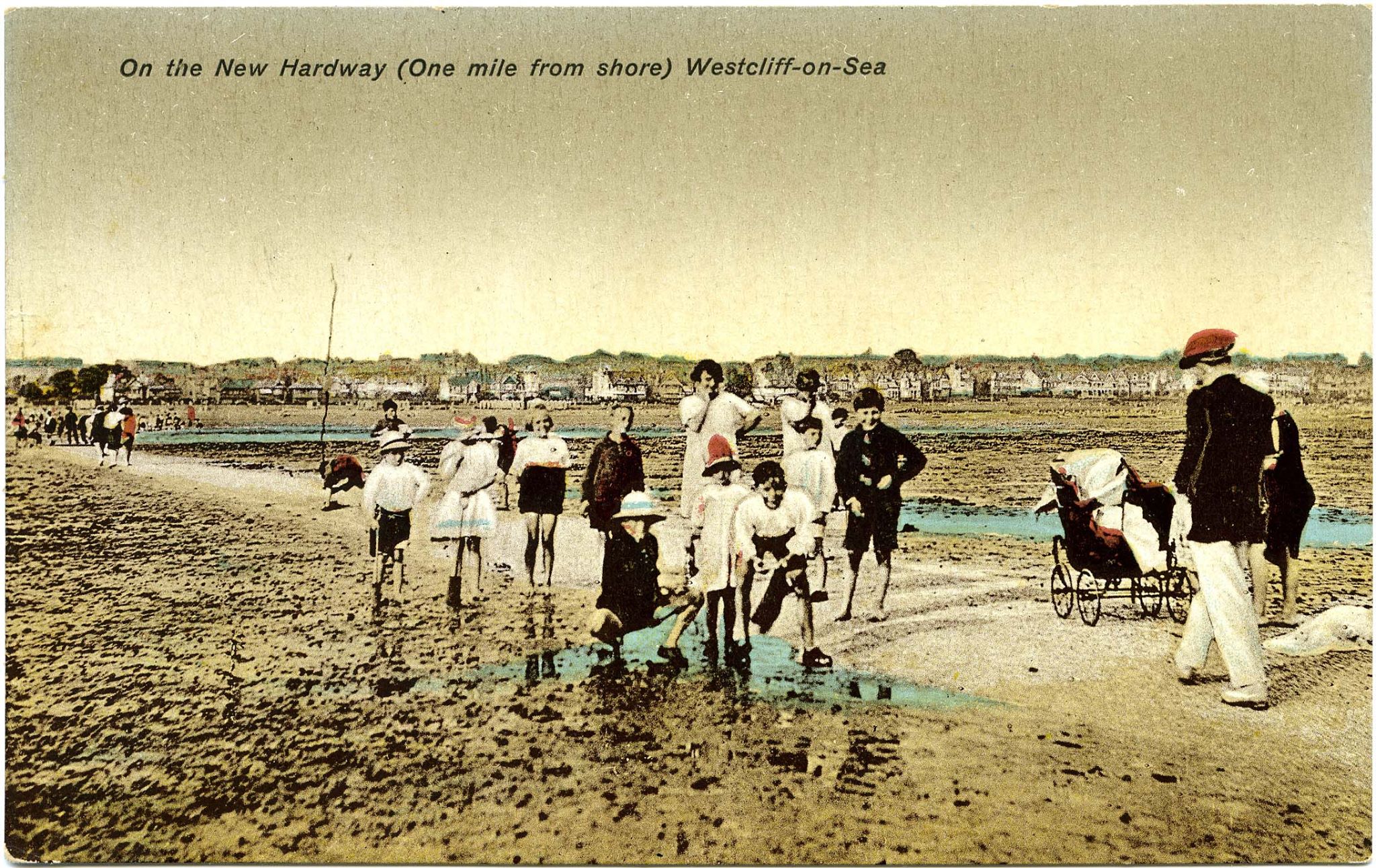
Tony Brown: No doubt each causeway has its own history. The one to the east of the Crowstone starts in Oct 1908 when the Council minutes show that the Corporation first considers the construction of a causeway “from the foreshore into deep water for the convenience of yachtsmen, boatmen fishermen etc” which is approved the following year. This contemporary PC celebrates its completion. (SEE IMAGE ABOVE)
Sources used:

Thank you for posting this – most informative.
My opinion is that the hards were used for commercial purpose prior to WW2, but it’s interesting that some WW2 UXO was discovered – and detonated – close to the Eastern Path a couple of weeks ago.
There are six hard paths but only the two near the Crowstone and opposite Toulouse Restaurant are in reasonable condition. The others which have all but disappeared beneath mud and shell beds are opposite Rossis, the Esplanade Pub (now flats), the Kursaal and Ocean Beach Restaurant. When the London Gateway opened and there was an increase in the dredging of the shipping channel, it corresponded with a build up of inshore mud and silt which was the start of the hard paths disappearing.